I like maps. In fact, I like them so much that I’ve become aware of their potential to dangerously mislead as much by what they reveal as what they conceal.
My love of maps stems from two formative experiences in my life. The first were the maps of J.R.R. Tolkien in his Middle Earth books. The second was my ability to get completely lost in my own home town, leading to tense periods of walking-denial as I stared hard at things and tried to figure out where the heck I was.
Anyway, I noticed something interesting about the map Tolkien drew for his Lord of the Rings trilogy. I actually noticed this years ago, but I haven’t posted in my blog for a while, so I thought I’d share it here. But first, the map:
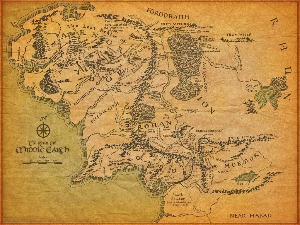
That is the original map from The Lord of the Rings. Now if I can call your attention to the lower-right, you can see MORDOR there bordered by impassable mountains. The mountains are key…

Now what you see above are the pre-World War 2 border changes of Germany right up to the beginning of World War 2. I want you to notice the shape of Germany’s northern border, as well as its southern border, particularly how it begins above Switzerland, and then curves down and then up past Italy and Yugoslavia, and then heads up in a curving path along Hungary and through Czechoslovakia before ending in a point.
Now, if you were to stretch the original LOTR map as I have, you can do so vertically until the borders of Mordor basically align themselves with the border of pre-WW2 Germany, and you can see the similarity more easily.

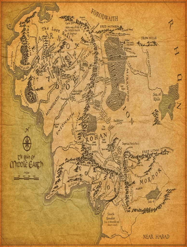
But what if you were to lay the stretched map upon a table to look at, what would the map look like then? You can see here that I’ve simulated putting the map down on a table, and have pretty much corrected the original deformation I gave it when I stretched it vertically.
THUS, what the LOTR Tolkien map really is, is a reference to something known to EVERYONE that experienced World War 2 when it happened, and they were following every initial loss of territory at the beginning of the war on their radios and in their newspapers, and then the eventual gain of territory until the fall of Nazi Germany.
Another way of saying this is that it was like a modern day easter egg in the Lord of the Rings that no one back then possibly missed, but over the decades, new generations forgot what the pre-ww2 borders of Germany looked like before the blitzkrieg began.
It was also to draw readers into the experience that Tolkien himself loved, which was to give them a clue what it was like to view a map upon a table and study it, rather than to hang one on a wall or view it on a screen. This was to help the readers imagine themselves brooding over a map and planning their course through it, and contemplating anxiously what REAL dangers may be along their path they don’t know about, and perhaps how they are going to resolve the obstacles they DO know about.

Leave a comment