Or: How Tolkien walked around map tables.

Sooo, what did I see in THIS one? Quite a bit actually, and it’s quite scattered, but hear me out. To make this simpler, I’m going to avoid the big reveal, and just show you where I think Tolkien got the idea for the design of this map. And here you go:

I want you to note that this is not a true-north view of Scotland, but one rotated counter-clockwise about maybe 30-degrees or something (see the north indication in the lower right). Now, the area in the center area of the map and upwards is The Northern Highlands, called so because of all the mountains there, which I should have guessed, but I only thought they called it that because it sounded cool.
Now I want you to notice a similarity between Mirkwood Forest in the Wilderland map, and the general outline of the The Northern Highlands. And to keep my promise, I believe it’s similar enough that Tolkien must have found inspiration for his map-making by simply shifting a real map of the world around on a table to change the canonical direction of the maps he drafted. Further, other real-life features on a world map appear as features in Tolkien’s map AND aligned with what directions they would be on a map of the world which wasn’t properly straight out in front of you.

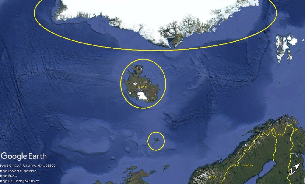
In my first example, as per the same skewd-rotation of Scotland, the Scandinavian Mountains of Norway and Sweden are in the upper portion of this image. This fits not as cooperatively as I’d like with The Grey Mountains in the Tolkien map. I asked ChatGPT what the environment of Scandinavia was like, and it said it was generally mountainous and grey. I was able to confirm its inexperienced opinion by looking myself via Google Images and concurred.
Further, there are three clear land bodies out from Scotland when the map is rotated this way, which are The Faroe Islands, Iceland, and Greenland. Keeping in mind that these are out in a line to the northwest from Scotland, look how Mount Gundabad is in the top-left corner of the Tolkien map, and how it is comprised of three peaks.

Now here in the Scotland map, in the center is the Isle of Skye, and to the left of it are the Hebrides.
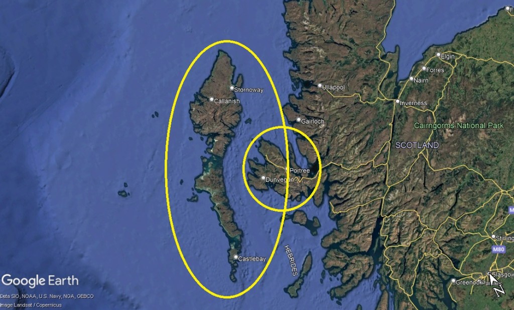
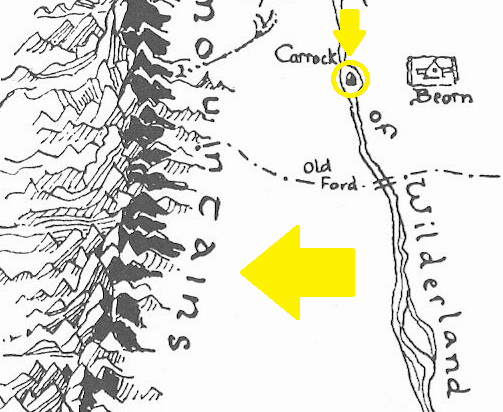
In the Tolkien map, in the small circle is a little island within the Great River, and to the left are the Misty Mountains. I will note that in the Great River of the Tolkien map there are no other islands, and that this island is perfectly situated with the location of the Isle of Skye. I also think it is interesting that Beorn lived nearby.
With a little research, the Hebrides are not mountainous or even hilly, but actually perfectly flat, and that due to their location and weather patterns, they are often foggy, reminding me of the Misty Mountains.
Also, in the book The Hobbit, the Great River was dangerous because some form of magic caused anyone who touched the water to get sleepy and then fall into it, perhaps to their death. This is precisely like the coastline of the Isle of Skye and north and south along the coast of Scotland, which are dangerous to swimmers because of its various riptides and tidal currents which will draw swimmers quickly too far out to sea to perish.
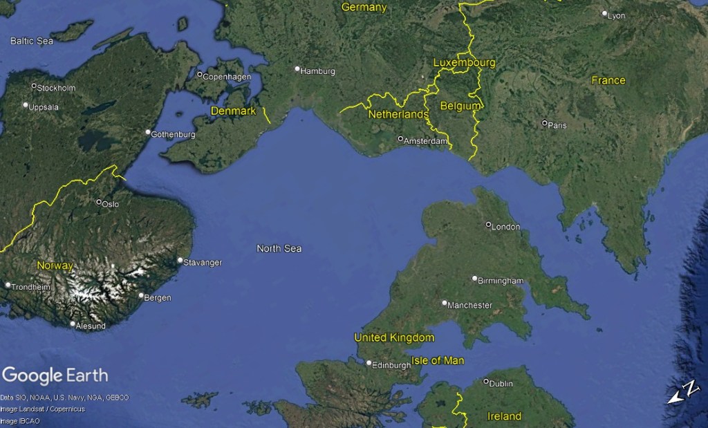

Now if you look at Scotland again when it is aligned to match the outline of Mirkwood Forest, you can see that Germany is at the very top, which means that on the Tolkien map it is directly east.
Remembering that the rise of Nazi Germany was occurring around the time Tolkien wrote The Hobbit and drafted the map for it, in that time Germany mined raw iron in the Ruhr Valley and Harz Mountains. The iron quality in these places wasn’t as good as the iron Germany currently imports from other places in the world, but in the mid-century it was THIS iron that was used to build the Nazi war machine. It should also be noted that unlike in modern times in an age of small wars which no one sees developing, erupting, and ending with little media coverage, in the mid-century everyone in Western Europe watched each other, and especially Germany very closely because of the First World War. Thus, even though the book and map were composed before World War 2, everyone was watching the politics and blossoming economy and industry of Germany with dread.

Now on the left side of the Tolkien map, at the top you can see Western Lands, and at the bottom Hobbiton. I believe that this is simply the concept of Western Civilization, and that the Hobbits of Hobbiton represent the culture and manners of the British.


Now if we orient the map of Western and Central Europe so that we peer into the grasslands of Western Russia, be can see that on Tolkien’s map this corresponds to the Withered Heath in the top-right. The top-right makes this the northwest, and this is the area of the map where the new mid-century Soviet threat was, as well as where Germany invaded Russia initially, and later the Soviets pushed Germany back west.
In this time, that area of the world was going through a drought, and a ‘Heath’ by the British definition is an area of open land covered with grasses, very few trees or bushes, and small flowers. It follows that a ‘Withered Heath’ would have few flowers. I believe this means that the English were very concerned about the eruption of another world war, and were learning as much as they possibly could about the conditions it would be fought in if it broke out.

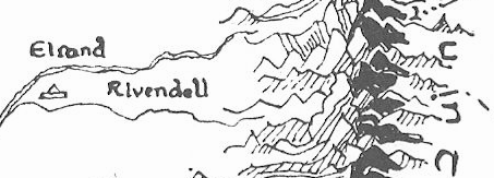
Lastly, even though there are lots of other details in the Tolkien map which also align with real geography, the place Rivendell is located in the Tolkien map corresponds to St. Kilda and where it is situated west of the Hebrides. St. Kilda is a small collection of islands which today are a UNESCO World Heritage Site. They used to be populated until the 1930’s, and after were only toured for its cliffs, seabird colonies, clear waters, wildflowers and grassy slopes, sea stacks, and untouched wilderness. I think Tolkien must have visited precisely for this reason by boat at some time in his life because of his love of the natural world.

Leave a comment